Difference between revisions of "Qinghai"
From Wiki China org cn
imported>Ciic |
imported>Ciic |
||
| (4 intermediate revisions by the same user not shown) | |||
| Line 2: | Line 2: | ||
---- | ---- | ||
| − | + | [[file:Qinghai.JPEG|thumb|200px|left|Qinghai]] | |
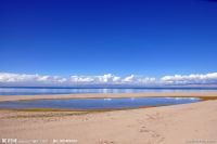
| − | Qinghai Province got its name from its Qinghai Lake, the largest inland saltwater lake in the country. It lies on the northeastern part of the Qinghai-Tibet Plateau in west China, bordering Gansu, Sichuan, Xinjiang and Tibet. As the origin of the Yangtze, Yellow, and Lancang rivers, Qinghai has an area of 720,000 sq km. Its territory includes 31.6 million ha of grassland, 589,900 ha of cultivated land and 250,000 ha of forests. The remaining are mountains, lakes, deserts, gobi and glaciers. | + | '''Qinghai Province''' (青海省) got its name from its Qinghai Lake, the largest inland saltwater lake in the country. It lies on the northeastern part of the Qinghai-Tibet Plateau in west China, bordering Gansu, Sichuan, Xinjiang and Tibet. As the origin of the Yangtze, Yellow, and Lancang rivers, Qinghai has an area of 720,000 sq km. Its territory includes 31.6 million ha of grassland, 589,900 ha of cultivated land and 250,000 ha of forests. The remaining are mountains, lakes, deserts, gobi and glaciers. |
[[Category:Provinces of China]] | [[Category:Provinces of China]] | ||
Latest revision as of 08:22, 5 June 2013
Qinghai
Qinghai Province (青海省) got its name from its Qinghai Lake, the largest inland saltwater lake in the country. It lies on the northeastern part of the Qinghai-Tibet Plateau in west China, bordering Gansu, Sichuan, Xinjiang and Tibet. As the origin of the Yangtze, Yellow, and Lancang rivers, Qinghai has an area of 720,000 sq km. Its territory includes 31.6 million ha of grassland, 589,900 ha of cultivated land and 250,000 ha of forests. The remaining are mountains, lakes, deserts, gobi and glaciers.
