Difference between revisions of "Yarlung Zangbo Grand Canyon"
imported>Graceshanshan |
imported>Graceshanshan |
||
| Line 1: | Line 1: | ||
| + | The [[Yarlung Zangbo River]] cleaves a straight niche from west to east before reaching the juncture of Mainling and Medog counties, where it swerves around towering Namjagbarwa (7,782 meters), the highest peak in the eastern section of the [[Himalayas]], creating the largest, U-shaped canyon in the world. In 1994, some Chinese scientists made an expedition trip along the canyon. Data published by the State Bureau of Surveying and Mapping following the expedition shows that the canyon starts from the Daduka Village, Mainling County in the north to Parcoka Village, Medog in the south. Stretching 504.6 km, the canyon is 2,268 meters deep on average, with the deepest point being 6,009 meters. The Colorado Canyon in the United States is 440 km in length while the Colca Canyon in Peru is 3,203 meters deep. In September 1998, the State Council officially approved the name of the canyon as "Yarlung Zangbo Daxiagu" (Yarlung Zangbo Grand Canyon). | ||
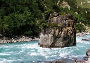
[[File:yzgc.jpg|thumb|left|Yarlung Zangbo Grand Canyon]] | [[File:yzgc.jpg|thumb|left|Yarlung Zangbo Grand Canyon]] | ||
| − | |||
[[Category:Canyons and gorges of China]][[Category:Geography of Tibet]] | [[Category:Canyons and gorges of China]][[Category:Geography of Tibet]] | ||
Revision as of 00:48, 13 July 2009
The Yarlung Zangbo River cleaves a straight niche from west to east before reaching the juncture of Mainling and Medog counties, where it swerves around towering Namjagbarwa (7,782 meters), the highest peak in the eastern section of the Himalayas, creating the largest, U-shaped canyon in the world. In 1994, some Chinese scientists made an expedition trip along the canyon. Data published by the State Bureau of Surveying and Mapping following the expedition shows that the canyon starts from the Daduka Village, Mainling County in the north to Parcoka Village, Medog in the south. Stretching 504.6 km, the canyon is 2,268 meters deep on average, with the deepest point being 6,009 meters. The Colorado Canyon in the United States is 440 km in length while the Colca Canyon in Peru is 3,203 meters deep. In September 1998, the State Council officially approved the name of the canyon as "Yarlung Zangbo Daxiagu" (Yarlung Zangbo Grand Canyon).
